🎉 Up to 70% Off Selected ItemsShop Sale
Peters World Map
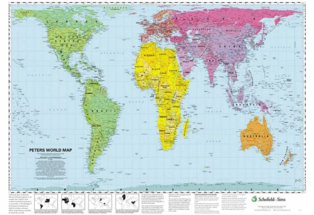
This accurate, colour-coded map shows all areas according to their actual size, with the North-South lines running vertically and the East-West lines running parallel. The poster features a brief discussion of the tendency of traditional maps to show countries incorrectly in proportion to one another, and describes the 'growing awareness of the interdependence of all nations and all peoples.'; ; Published: 21/02/2002
$24.40
Peters World Map—
$24.40
Peters World Map
This accurate, colour-coded map shows all areas according to their actual size, with the North-South lines running vertically and the East-West lines running parallel. The poster features a brief discussion of the tendency of traditional maps to show countries incorrectly in proportion to one another, and describes the 'growing awareness of the interdependence of all nations and all peoples.'; ; Published: 21/02/2002
Product Information
Product Information
Shipping & Returns
Shipping & Returns
Description
This accurate, colour-coded map shows all areas according to their actual size, with the North-South lines running vertically and the East-West lines running parallel. The poster features a brief discussion of the tendency of traditional maps to show countries incorrectly in proportion to one another, and describes the 'growing awareness of the interdependence of all nations and all peoples.'; ; Published: 21/02/2002